eKatastar and Geoportal: how to find a plot and property certificate online
For a basic plot check, a few minutes online is often enough. eKatastar gives you data from the cadastre, while on the Geoportal you can see the plot's location, boundaries and orthophoto.
Official portals: ekatastar.me · geoportal.co.me. This page is an independent guide; elaborat.me is not affiliated with the portals.
eKatastar or Geoportal — which one you need
| eKatastar | Geoportal | |
|---|---|---|
| What it is | Search of real estate cadastre data | Map with spatial data |
| Shows | Plots, buildings, separate units, rights holders, encumbrances | Location and boundaries of plots, orthophoto, other layers |
| Search by | Cadastral municipality + plot number or certificate number | Location on the map or plot number |
| Use it when | Checking the owner, area, mortgage | Looking for where the plot is and what is on it |
eKatastar: step-by-step search
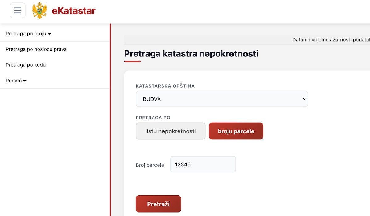
- Get your details ready. You need the name of the cadastral municipality (KO) and the plot number. They appear on a contract, a decision, an old property certificate (list nepokretnosti) or a copy of the cadastral plan (kopija plana).
- Open ekatastar.me and log in. You log in with your ID card and the electronic identification system NSeID.
- Select the municipality and cadastral municipality. One municipality has several KOs — check the exact name.
- Enter the plot number exactly as registered, including the sub-number (e.g. 1234/2).
- Read the result: data on the plot, buildings, rights holders and encumbrances.
- Need a document? Order a property certificate and pay through the ePlaćanje service. Amount: 5 € (2 € taksa + 3 € naknada). Such a certificate is just as legally valid as one from the counter.
Geoportal: find the plot on the map
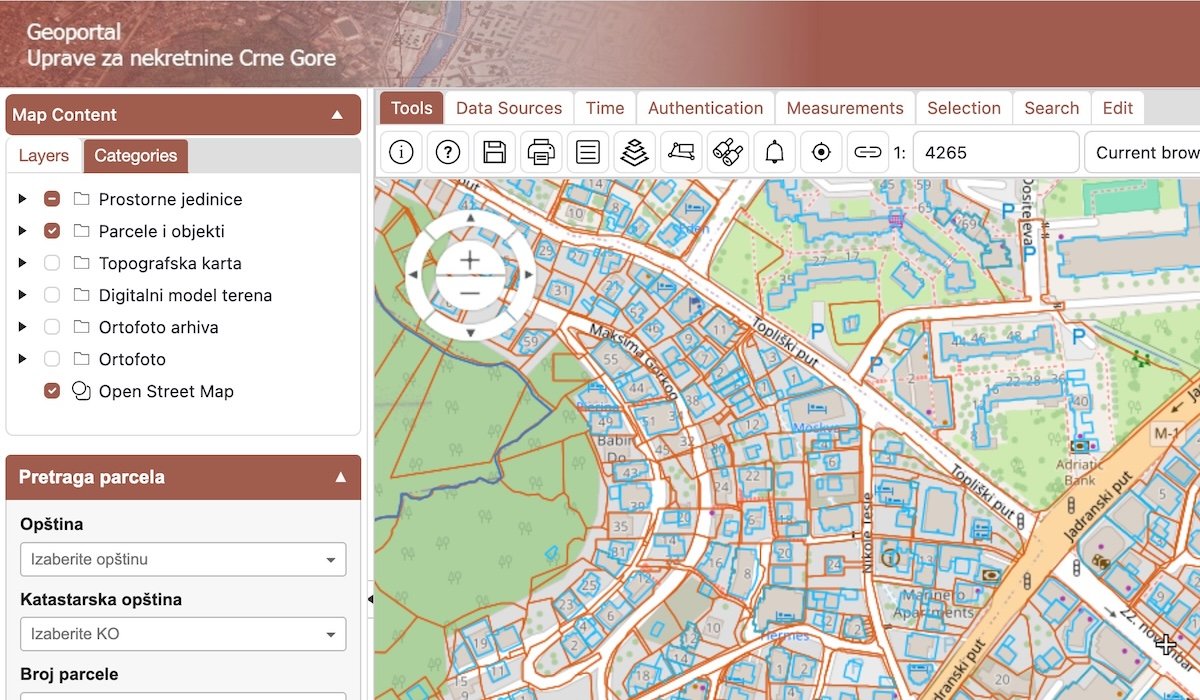
- Open geoportal.co.me and turn on the cadastral plots layer.
- Find the location by searching or by moving the map.
- Click on the plot to see its number and basic data.
- Turn on the orthophoto to compare the situation on the ground with the cadastre.
What you cannot reliably establish online alone
- The exact boundary on the ground. A line on the map is not a physical boundary. For the boundary, you need boundary marking (omeđavanje).
- Unregistered buildings. A house that is not registered does not exist in eKatastar, even if it is visible on the orthophoto.
- Pending procedures. An application that has not yet been decided may not be visible.
- An on-screen view is not a document. For a bank, notary or court, order an official certificate (online or at the counter).
If the data does not match — what next
| What you see | What it means | What to do |
|---|---|---|
| The house is on the orthophoto but not in eKatastar | The building is not registered | Cadastre registration; if it has no permit — legalisation |
| The plot area does not match the contract | Measurement difference or old survey | Surveyor: survey and plot identification |
| No plot exists under the number in the contract | The number has changed (new survey, subdivision) | Identification of plots from the old and new survey |
| An encumbrance is registered (mortgage, annotation) | A third party's right or a procedure | Check with the cadastre or a lawyer before buying |
| The flat is not registered as a separate unit | The building has not had a unit division | Unit division (etažna razrada) |
Orthophoto and legalisation
Under the new legalisation law, one of the conditions is that the building is visible on the orthophoto image published by the competent ministry. That is why the Geoportal is useful even before you start legalisation. What else the law provides.
Frequently asked questions
How much does a property certificate cost via eKatastar?
According to data from July 2026: 5 € in total (2 € fee + 3 € charge), paid in a single transaction through the ePlaćanje service.
What is NSeID?
The national electronic identification system. It lets you log in to state portals with your ID card.
I don't know the plot number. How do I find it?
On the Geoportal, find the location on the map and click on the plot. The number is also written on the contract, the inheritance decision or the copy of the cadastral plan.
What is a cadastral municipality (KO)?
Part of a municipality's territory for which a separate plot register is kept. The same plot number exists in different KOs, so the KO is a required detail.
Information, not legal advice. This text explains a general procedure. Regulations change and every case is different. For property decisions, disputes and deadlines consult a lawyer or the competent authority. →
Sources: ekatastar.me; geoportal.co.me. Updated: