Cadastral plot, cadastral plan and copy of the plan
These terms are often confused. Below are short explanations, examples and situations in which you may need a particular document or piece of data.
Key terms in one place
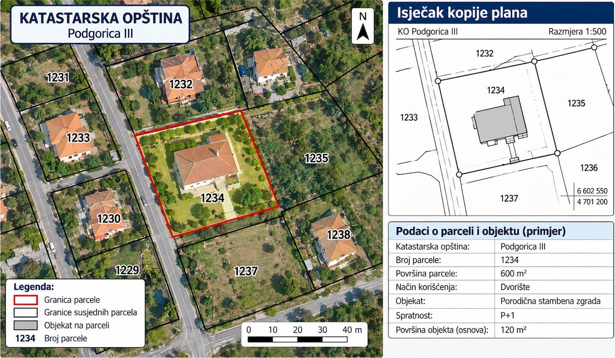
- Cadastral plot (katastarska parcela, KP)
- A piece of land with its own number within a cadastral municipality (KO), with boundaries and an area. Example: KP 845/3, KO Budva. A number with a slash means the plot was created by division.
- Urban planning plot (urbanistička parcela)
- A plot defined by a planning document (DUP — detailed urban plan, or spatial-urban plan, PUP) for construction. It can cover several cadastral plots or part of one. More about UTU and DUP.
- Cadastral plan (katastarski plan)
- A map of an entire cadastral municipality showing plot boundaries and numbers, and buildings. It is part of the official records.
- Copy of the cadastral plan (kopija plana)
- An extract from the cadastral plan for specific plots. It is issued by the cadastre. It is required for design work, permits and court proceedings.
Where to find the plot number
- Sale and purchase contract, deed of gift, inheritance decision
- An old property certificate (list nepokretnosti) or possession sheet (posjedovni list)
- Property tax assessment
- Geoportal: click on the plot on the map — instructions
Old and new surveys: how plot numbers are linked
When a new survey is carried out in a cadastral municipality, plots receive new numbers and more accurate areas. That is why a number from an old contract sometimes “does not exist” in eKatastar.
Plot identification is a surveying job that links the old and new plot number and shows differences in boundaries and area. You need it for inheritance, purchases based on old documents and court proceedings.
| Symptom | Solution |
|---|---|
| The number from the contract does not exist in eKatastar | Identification between the old and new survey |
| The area on the certificate is smaller than in the contract | Identification + boundary survey |
| A neighbour claims the boundary is elsewhere | Boundary marking (omeđavanje) |
Buying a building plot? Check these three things
- The plot number and KO from the contract exist in eKatastar, and the seller is the owner.
- The plot on Geoportal is where the seller shows it to be on the ground.
- The planning document (DUP/PUP) allows the construction you are planning.
If you have doubts about the boundaries, a surveyor can mark the boundary points before you sign the contract.
What else you can do with your plot
Updated: