Survey base maps for design: site plan and cadastral-topographic plan
An architect or designer needs an accurate picture of the site before preparing a design. A survey base map shows the plot boundaries, elevations, existing buildings, roads and, where needed, utilities.
Which survey base map you need
| Base map | Contents | Used for |
|---|---|---|
| Site plan (situacioni plan) | Plot, buildings, distances, access | Applications to authorities, concept designs, showing a building's position |
| Topographic plan | Relief (contour lines, spot heights), buildings, vegetation, roads | Design on sloping ground, levelling |
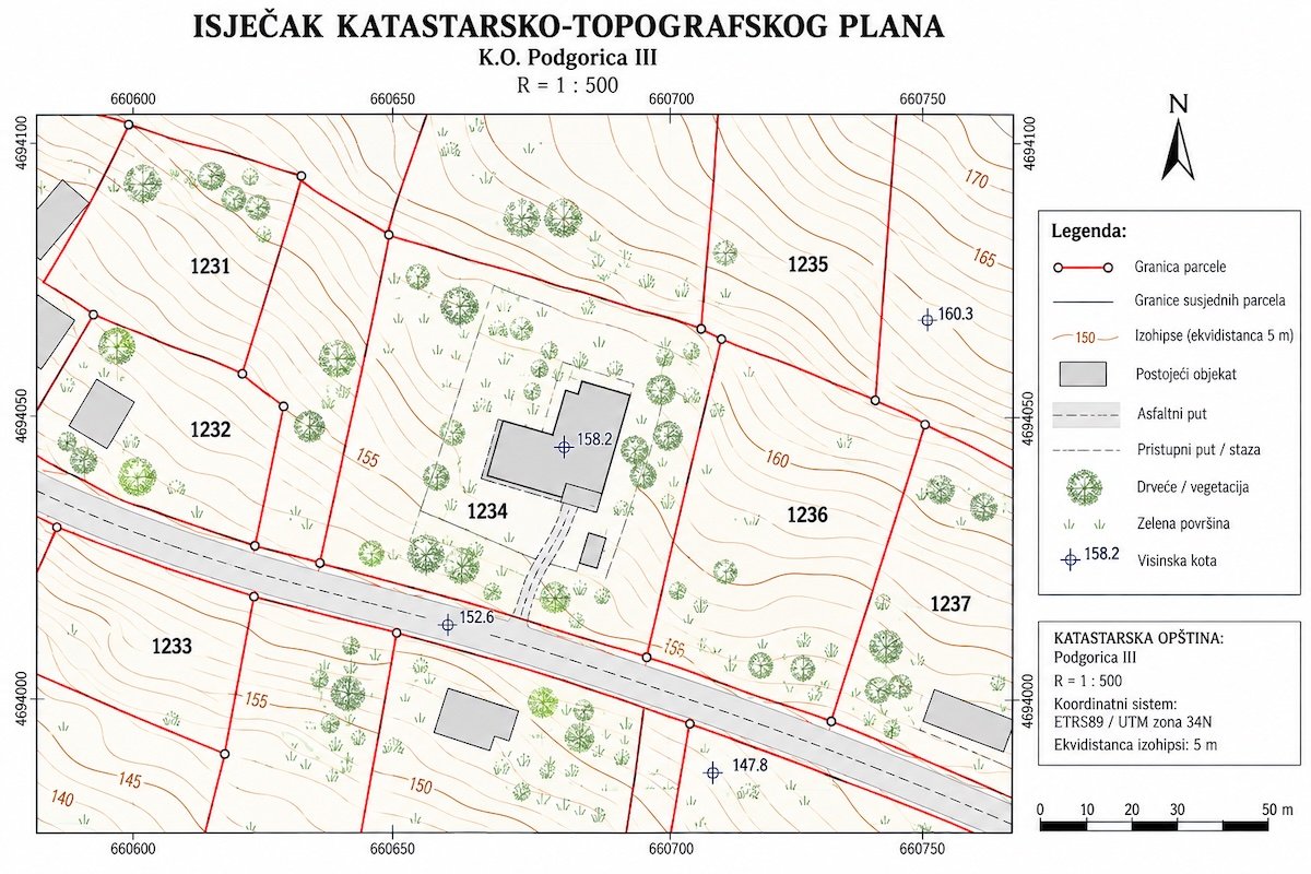
| Cadastral-topographic plan (katastarsko-topografski plan) | Topography + cadastral boundaries and plot numbers | Main design, UTU, permits |
| Underground utilities survey | Water supply, sewerage, electricity, telecoms | Connections, infrastructure projects |
If you are not sure what is needed, check with your designer which scale and content they require. In many cases a cadastral-topographic plan is used.
What you get
- A drawing in DWG format (for designers) and a PDF for printing
- Coordinates in the national coordinate system
- Spot heights and contour lines (for topographic plans)
- Certification by a licensed surveying organisation
Larger sites: drone surveying
For large or hard-to-reach areas, a drone can speed up the survey and allow an orthophoto and terrain model to be produced. When a drone is worth it.
Price and timing
Site plan: on request. Cadastral-topographic plan: on request. It depends on the area, the terrain and the density of detail.
Next steps
Frequently asked questions
How long is a survey base map valid?
Until the situation on the ground changes. Some authorities require a base map no older than a certain period — ask your designer.
Can the designer use a copy of the cadastral plan instead of a base map?
Not for the main design. A copy of the cadastral plan (kopija plana) has no elevations or terrain details.